


Several centimetres of snow could settle on the North York Moors, with all of us seeing showers turn increasingly to snow.
The Met Office have issued a Yellow Weather Warning for ICE for the whole Yorkshire Coast, valid from 6:00pm today until 12:00pm tomorrow:
Frequent wintry showers running down the east coast are likely to fall on frozen surfaces in places, leading to the formation of icy patches. These showers are likely to fall as snow on high ground, with the potential for a few centimetres to accumulate on the North York Moors.
Jo Farrow, a Forecaster from NetWeather, told Paddy at Breakfast that we can all expect some snow in the next few days, especially tonight and Thursday night:
Jo also says we can expect sub zero temperatures at night and temperatures barely above freezing by day:
But how long will the cold snap last? Jo thinks it's here to stay for the rest of the week and into next week too:
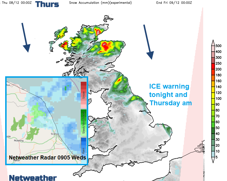
Jo also shared this latest radar image and snow levels forecast:
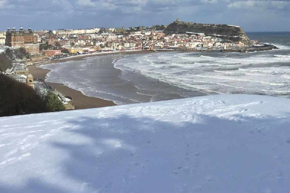
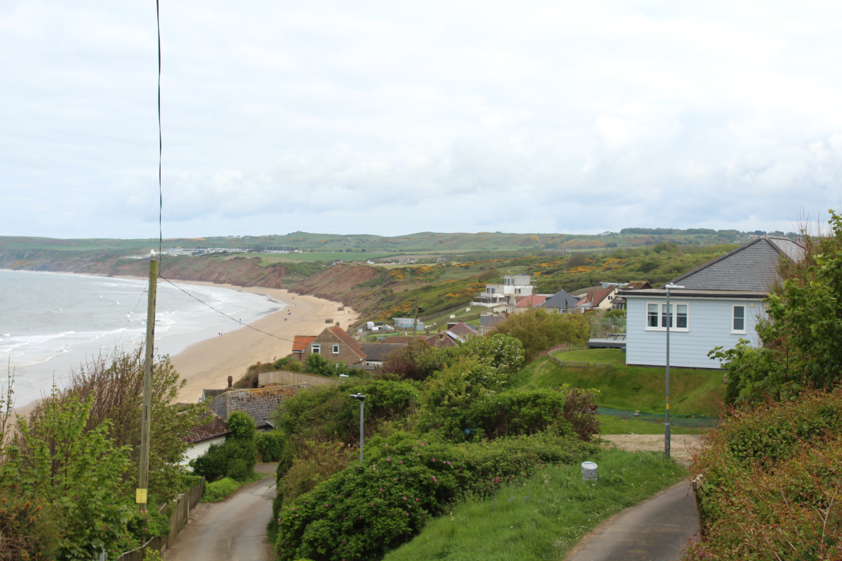
The Yorkshire Coast could see scenes like this at times this week:


 North Yorks Mayor Says “Quite a Low Bar” For Councillors To Say “Step Up To The Mark”
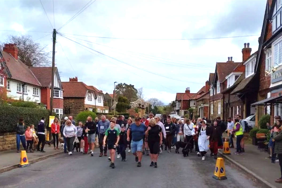 Scalby Easter Walk Returns to Raise Funds for Futureworks Charity
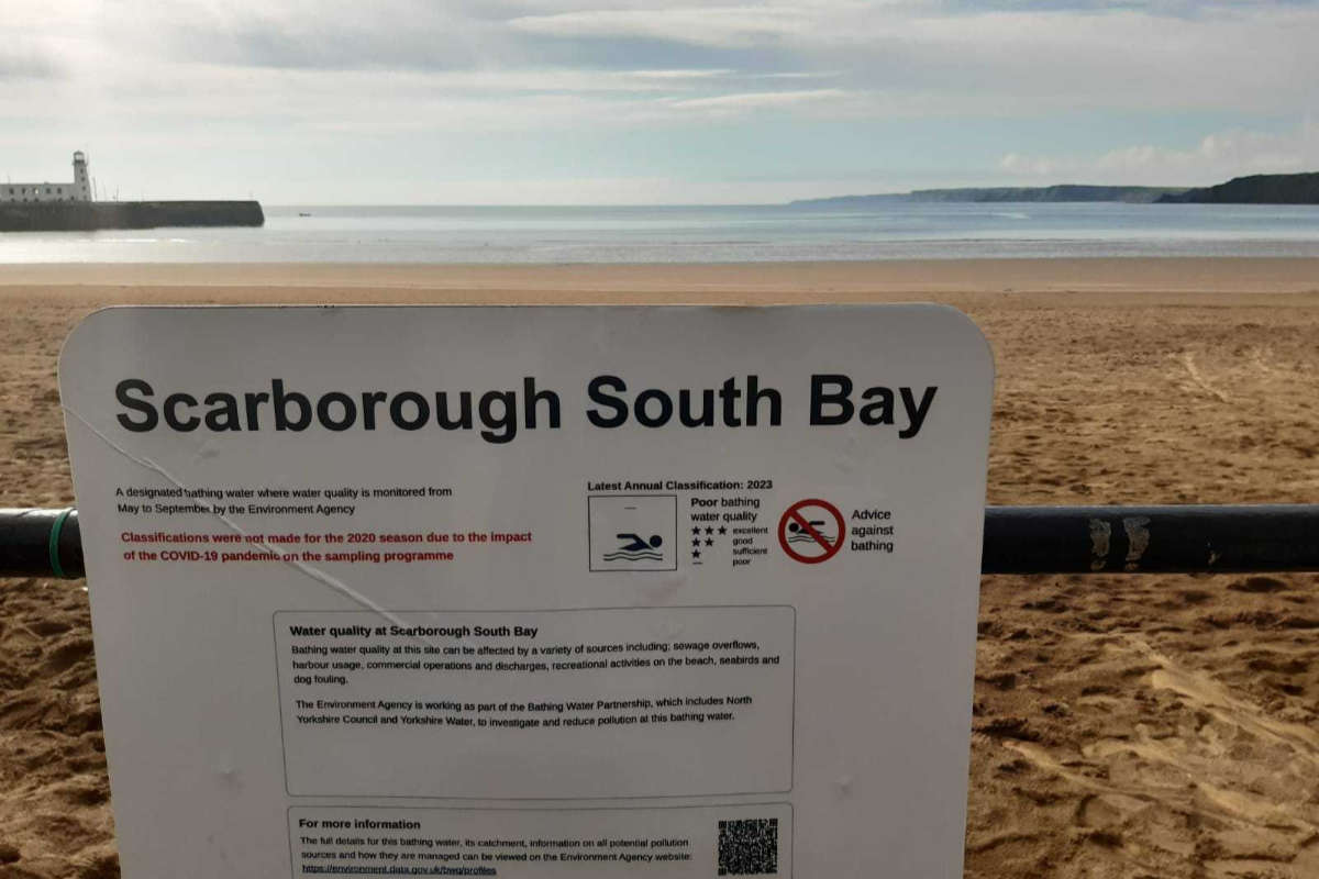 Scarborough Water: Councillors Clash Over Climate Change References
 Bid Submitted For 8 Million North East Coast Project
 Investigation Underway After Man Seen Kicking Dog In Scarborough
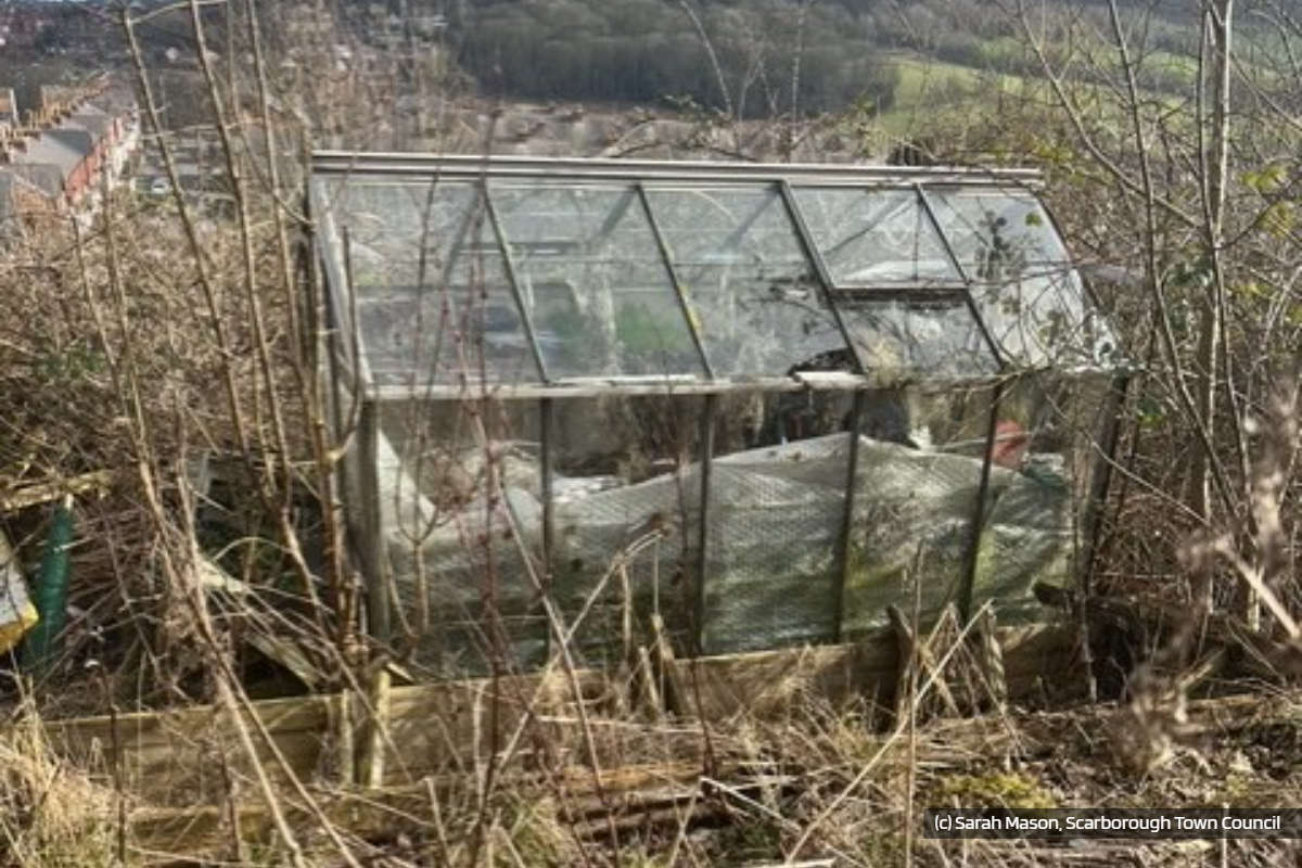 Town Council Decry Abandoned, Derelict and Unused Scarborough Allotments
 Motorcyclist Sustains Life-Threatening Injuries Following Collision Near Driffield
 Whitby Town Launches Sponsor A Seat Plan
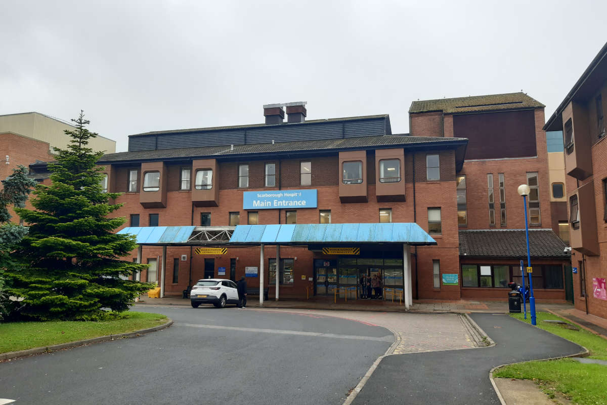 Scarborough MP: "It’s up to the NHS Trust to improve the services”
 Filey Food Festival Falls Foul Of Storm
 Storm Dave Aftermath Brings Down Trees And Disrupts Travel Along The Yorkshire Coast
 Farage Gives Views on East Riding Mayor


Comments
Add a comment