


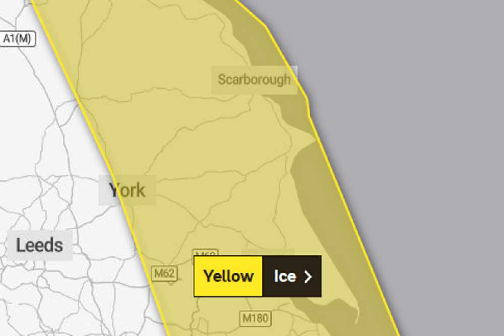
The first Met Office warning is in force from 4:00pm today until 10:00am tomorrow.
They say further showers this evening and overnight could lead to ice on untreated surfaces as temperatures plummit to well below freezing.
Some of the showers may be wintry inland but the chance anything other than isolated and very small accumulations of snow is very low.
A second Met Office weather warning for ice covers the whole Yorkshire Cooast from 5:00pm Thursday until 11:00am Friday.
In it, they say showers, with a mixture of rain, sleet and snow, are expected to fall onto frozen surfaces leading to icy stretches forming.
In addition, a more persistent spell of rain and hill snow is likely to spread south across northern England and north Wales during Thursday evening and night. Whilst ice is expected to be the main hazard, snow is likely in place too.
Snow is most likely to fall over The Pennines, North York Moors and the high ground of Wales, with 1-3 cm possible here.
Elsewhere, whilst some snowfall is possible, accumulations are likely to be slight and temporary.

 Scarborough Athletic Stunned By Minnows in Senior Cup
 Pickering and Filey MP Criticises Government for ‘Unfair’ Rural Funding Settlement
 East Riding to Introduce Weekly Food Waste Collections Amid Long-Term Funding Fears
 Whitby Town Again Hit By Second Half Slaughter
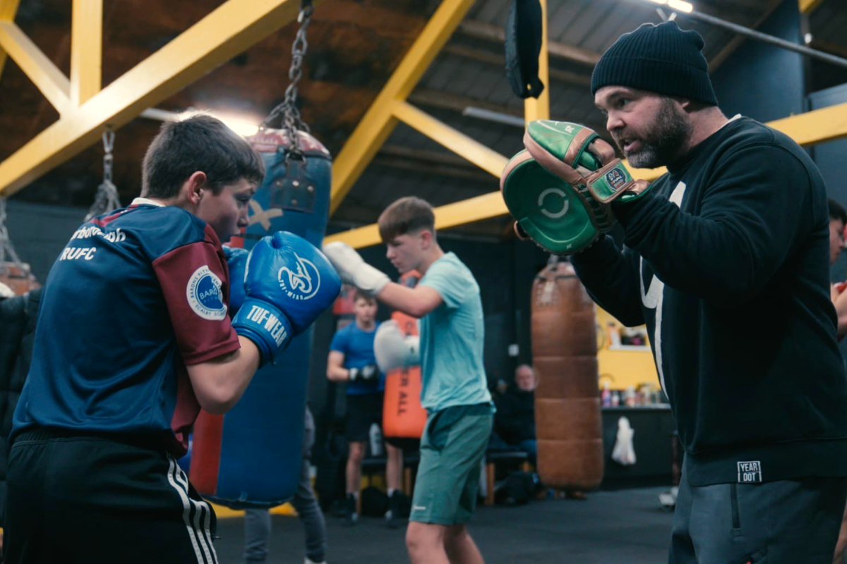 Eastfield Boxing Club Film to Get Scarborough Premiere
 Scarborough Café and Flat Plans Opposed by Town Councillors
 Bridlington Town Beaten Again Despite Improved Showing
 Scarborough Chip Shop's Alcohol Bid Approved Despite Concerns
 East Riding Leaders Sound Alarm Over Government's 'Fairer Funding' Review
 Precept Increase Proposed for Whitby Residents in Draft Budget
 North York Moors Park Authority Agrees Move to New £4m HQ


Comments
Add a comment