


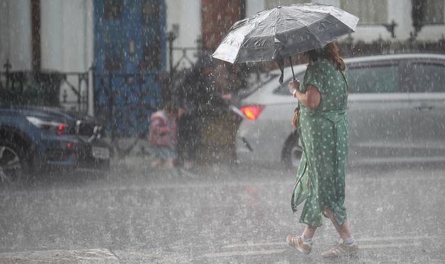
A tornado could batter parts of the UK, experts are warning - as southern England endures heavy rain following the driest start to spring in decades.
Met Office meteorologist Alex Burkill said it was "not out of the question that we could see a funnel cloud, maybe even a brief tornado across parts of the South East" of England on Wednesday, with southern areas facing thunder, lightning, and hail.
He added there was a "bit of a North-South split in our weather through today".
"Northern parts having a lot of fine, sunny weather, meanwhile in the South we've seen some wet weather push its way in... and there will be further showery bursts to come as we go through the rest of today," he said.
Read more from Sky News
West Nile virus found in UK for first time
Two dead after falling from migrant boat
Will there be a hosepipe ban?
Wednesday's showers follow the driest start to spring in nearly six decades.
As of Friday, 80.6mm of rain had been recorded for the UK in spring 2025, nearly 20mm less than the record low for the full season of 100.7mm set in 1852.
The Environment Agency is warning that it could contribute to drought this summer if there continue to be long periods without any rainfall.
Drier weather to return tomorrow
The UK is set to return to more dry weather on Thursday, with only a few showers forecasted in the South West of England.
They will not be "as intense" as those throughout the UK today, Mr Burkill said, with "a good amount of sunshine on offer" elsewhere.
Friday is due to be "mostly fine" but more wet and windy conditions are earmarked for the weekend.
Mr Burkill described this week's wet spells as a "real change from what we've become used to so far this spring".

(c) Sky News 2025: UK weather: Tornado and funnel cloud could hit parts of country today, Met Office forecaster

 Donald Trump ambushes South African president at White House meeting by playing video alleging 'genocide'
 Spurs beat Man Utd to win Europa League
 Member of Kneecap charged with terror offence
 Chris Brown released on bail - but must pay £5m security fee
 Jay Slater's mother breaks down in tears at inquest - as friends fail to appear as witnesses
 Jay Emmanuel-Thomas: Footballer admits plot to smuggle £600,000 of cannabis
 Sex offender found with six-year-old girl after facial recognition technology spots him
 Donald Trump's administration officially accepts $400m plane as gift from Qatar