
Amber and yellow weather warnings for snow and ice are in place across the UK, with some parts already hit by freezing temperatures and heavy snowfall.
Updated warnings were issued on Wednesday for parts of East Anglia and the South West.
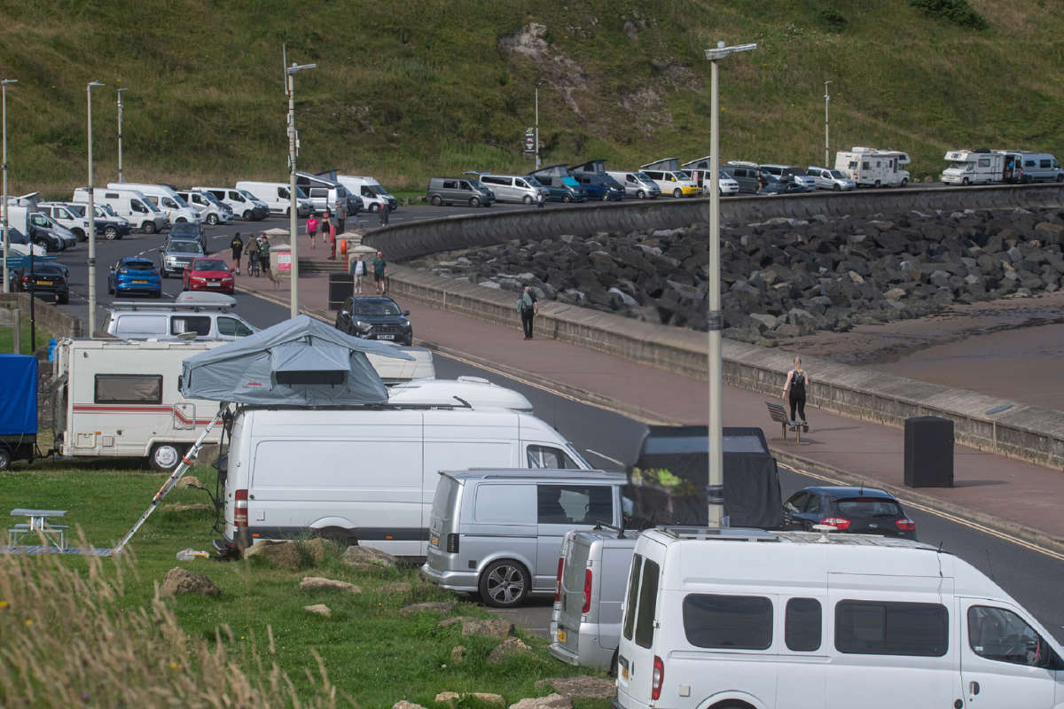
Wintry conditions are expected to continue closer to coastal areas after up to 7cm (2.75in) of snow fell in parts of the UK, forecasters said.
Snowfall has been recorded in northern areas of the UK, as well as in central parts and as far south as London.
Met Office weather stations in Lake Vyrnwy in Powys, Wales, recorded 7cm of lying snow at 8am.
Other weather stations reporting lying snow include Lerwick in Shetland which saw 5cm, 4cm in Loch Glascarnoch and 7cm in Altnaharra, both in the Scottish Highlands, 2cm in Aviemore, and 1cm each in Dyce, Aberdeenshire, Drumalbin in Lanarkshire and at Redesdale Camp in Northumberland.
The Met Office warned the wintry weather "could create some particularly tricky travel conditions".
A spokesman said: "We will continue to see wintry showers on the windward coasts, so north Scotland as well as the east and west coasts of the UK."
A yellow warning for ice earlier on Wednesday was later adjusted to potentially impact South Wales, parts of northern England and northern and southeastern Scotland.
Most of northern Scotland is under a yellow warning for snow and ice until 9pm on Thursday.
Check the forecast for your area
In East Anglia, a yellow warning for snow and ice is in place from 5pm on Wednesday to 11am on Thursday.
In Cornwall, parts of Devon, and west Wales, the warning for snow and ice applies from midday on Wednesday to 11.59pm on Thursday.
A yellow warning is in place for northern and northeastern England and southeastern Scotland from Hull in the south to Eyemouth in the north, from midnight on Wednesday to 11.59pm on Thursday.
Read more: 'Wintry blast could be a dry run for a cold December'
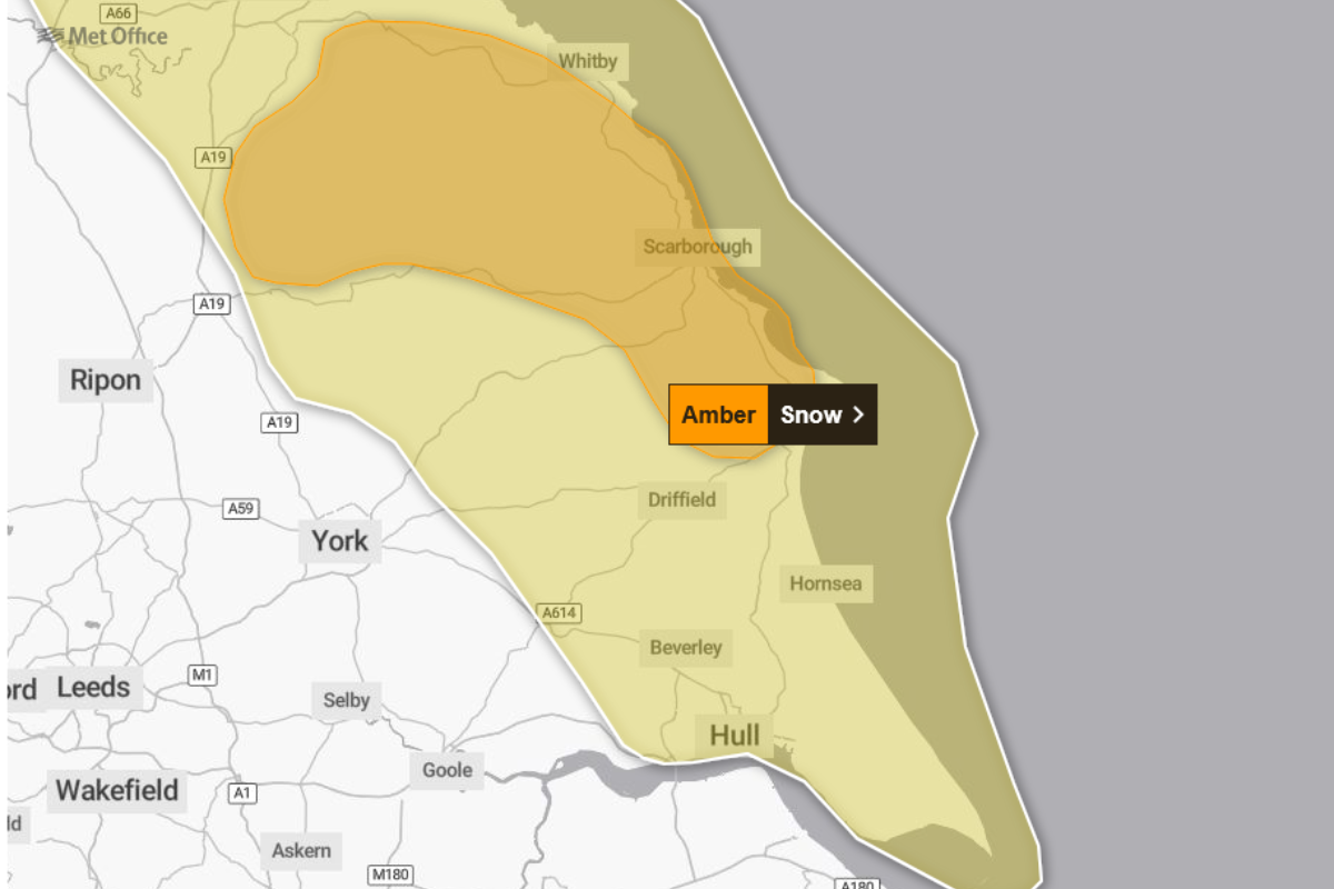
An amber weather warning for snow has been issued for parts of Yorkshire on Thursday between 3am and 9pm - with forecasters warning of significant accumulations of snow.
Frequent wintry showers will feed inland from the North Sea, making conditions difficult over the North York Moors and parts of the Yorkshire Wolds.
By the end of Thursday, as much as 15-25cm may have accumulated on hills above 100m elevation, which is likely to cause "substantial disruption", the Met Office said.
It added that power cuts and travel delays on roads were likely, possibly stranding some vehicles and passengers.
Temperatures could fall to as low as -11C in some parts of Scotland on Thursday night.
Untreated surfaces could become 'instant ice rinks'
Sky News weather presenter Jo Wheeler said falling temperatures on Wednesday night could make untreated roads and pavements "instant ice rinks".
She said: "Tonight, temperatures will plummet under largely clear skies.
"Rural areas can expect more spectacular sub-zero temperatures with a widespread and penetrating frost by dawn.
"And the ice - that may be a problem. Sub-zero temperatures will render untreated roads and pavements instant ice rinks with great care needed."
'Winter hazards are likely through the next few days'
Met Office Chief Forecaster Neil Armstrong said: "Cold Arctic air from the north is firmly in charge of the UK's weather, bringing the first notable cold snap of this autumn and giving an early taste of winter weather.
"As a result, winter hazards are likely through the next few days, with snow and ice a particular hazard, and the coldest conditions likely on Wednesday and Thursday.
"Wintry showers will affect areas exposed to the brisk northerly wind, in particular Northern Ireland, southwest Wales, southwest England, northeast England and across the northern half of Scotland.
"Whilst not all places will see lying snow, where showers are most frequent accumulations of 2-5cm will be possible.
"On higher ground in Scotland, 15-20cm could accumulate, and potentially as much as 15-25cm over the North York Moors and Yorkshire Wolds."
Ice will be an ongoing hazard, particularly overnight, in the coming days, warned the Met Office.
But conditions will turn drier for many by Friday, with milder temperatures and rain reaching western areas later in the day.
Do not be 'caught out', motorists warned
Darren Clark, of the National Highways, urged motorists to "prepare for winter".
"We have more than 530 gritters available nationally and we can rapidly call on additional reserves when snow hits or conditions demand it," he said.
"We work closely with the Met Office, receiving updated forecasts throughout the day and our crews are on duty around the clock, ready to head out whenever they're needed.
"We're also urging drivers to prepare for winter, and not be caught out by it.
"Quick checks, such as topping up fuel and screenwash, checking lights and tyres, and planning ahead, can make all the difference when the weather turns."

(c) Sky News 2025: UK weather: Amber and new yellow Met Office warnings in place as parts of UK hit by heavy snow

 Former Met Police officer David Carrick found guilty of more sexual offences
 Inflation slows to 3.6%, but food costs shoot upwards
 UK 'moving at glacial pace' on national plan for defending foreign attack, say MPs
 Man charged with further offences following Huntingdon train stabbing
 Wintry blast could be a dry run for a cold December, forecasts suggest
 Ultra-processed foods leading cause of 'chronic disease pandemic', say experts
 Best and worst parcel delivery companies revealed
 What is the mysterious Yantar 'spy ship' - and is it mapping Britain's undersea cables?
 What is each supermarket's policy if your delivery is late?