


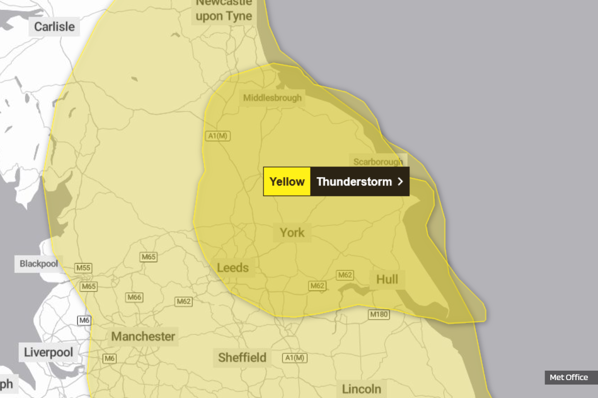
Residents along the Yorkshire coast are advised to prepare for potential disruption as two distinct yellow warnings for thunderstorms have been issued.
The first impacts are expected from Friday afternoon, extending through much of Saturday. Forecasters are urging the public to remain vigilant, highlighting risks including flooding, travel delays, and power outages.
The initial yellow warning specifically covers Friday afternoon and evening from midday to 8pm, indicating that thunderstorms bring the potential for disruption to transport and infrastructure. This period is expected to see showers and thunderstorms developing across parts of northern England early Friday afternoon, before becoming more concentrated across parts of northeast England. During this time, delays to train services are possible, along with some short-term loss of power and other services. The warning also highlights the risk of some damage to a few buildings and structures from lightning strikes.
Driving conditions are expected to be affected by spray, standing water and/or hail, leading to longer journey times by car and bus. Forecasters say that 15-25 mm of rain is possible in less than an hour, and should storms become aligned across similar areas, 40-60 mm of rain is possible, with these higher totals most likely over the North York Moors. Beyond the rain, frequent lightning and large hail are also possible. These storms are forecast to ease and clear into the North Sea by Friday evening.
A second, distinct yellow warning then takes effect from late Friday, continuing through much of Saturday. This warning indicates that areas of heavy, thundery rain may lead to disruption to transport and travel. This includes the potential for spray and sudden flooding to create difficult driving conditions and necessitate some road closures. Further impacts could see power cuts, with other services to some homes and businesses potentially being lost.
Safety guidance also highlights that flooding of homes and businesses could happen quickly, with damage to some buildings from floodwater, lightning strikes, hail or strong winds. There is also a warning that "fast flowing or deep floodwater is possible, causing a danger to life," and that some communities might become cut off if roads flood.
Experts say that rain will likely be locally torrential, with "20-30 mm in less than an hour in many places" and "60-90 mm in less than three hours possible in a few places". Beyond the heavy rain, "impacts from frequent lightning, gusty winds and large hail are also likely," according to forecasters.
In light of these warnings, authorities are providing crucial safety advice for residents. It is recommended to consider if your location is at risk of flash flooding and, if so, to consider preparing a flood plan and an emergency flood kit. Ahead of gusty winds, it is advised to "prepare to protect your property and people from injury" by ensuring "moveable objects or temporary structures are well secured," including items such as bins, garden furniture, trampolines, tents, gazebos, sheds, and fences.
For those planning to travel, guidance suggests giving yourself "the best chance of avoiding delays by checking road conditions if driving, or bus and train timetables, amending your travel plans if necessary". The Met Office, the UK's national weather service, "recommends staying up to date with the weather forecast in your area" when a weather warning is issued, as conditions can change quickly.
Furthermore, preparing for power cuts is advised, with the instruction that "people cope better with power cuts when they have prepared for them in advance". This preparation includes gathering "torches and batteries, a mobile phone power pack and other essential items".
For individuals who find themselves outdoors during a thunderstorm, safety experts provide clear instructions: "protect yourself by finding a safe enclosed shelter (such as a car)". They strongly advise against sheltering "under or near trees, or other structures which may be struck by lightning," and recommend that if you are on an elevated area, you should "move to lower ground".

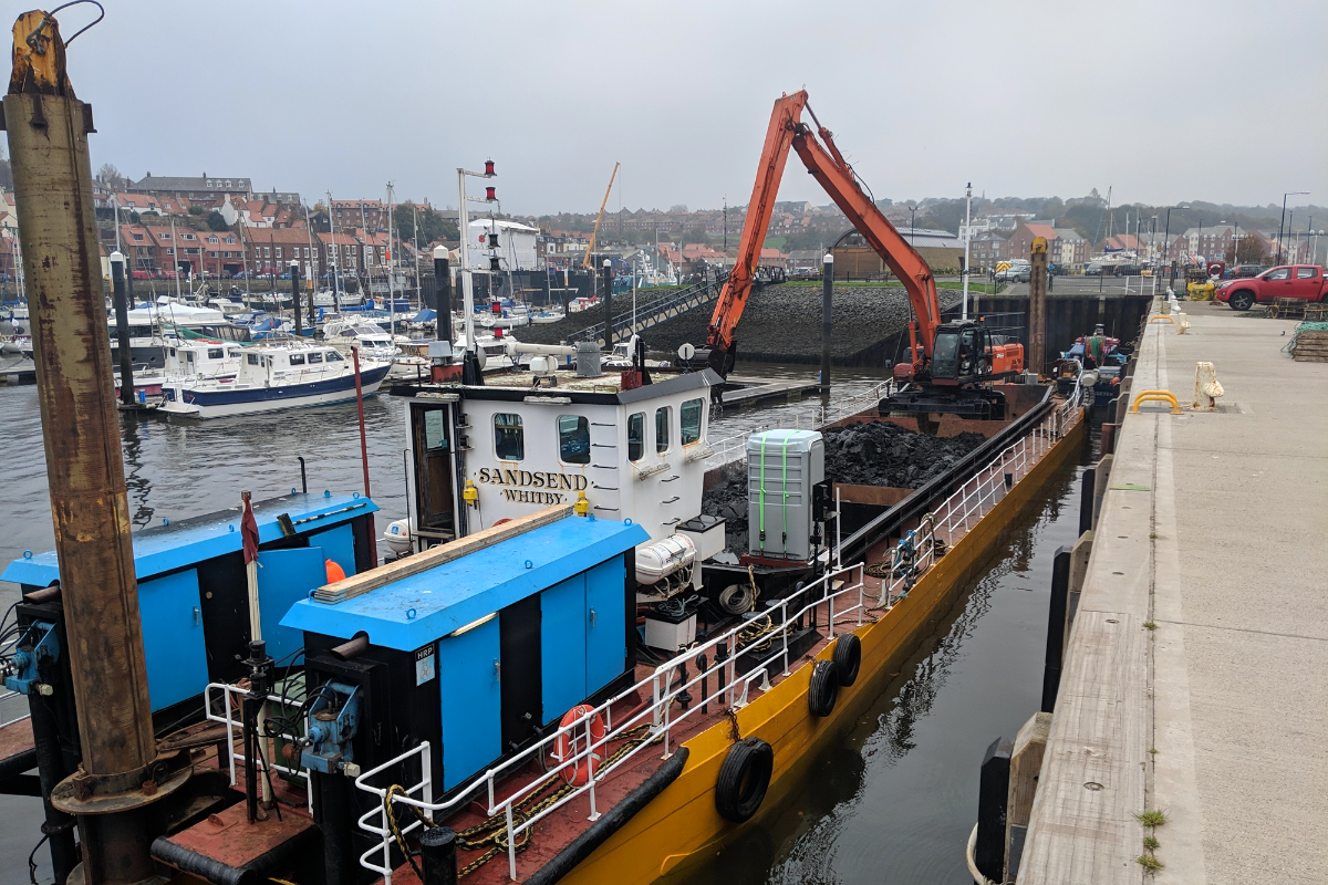 Dredging Boost for Whitby and Scarborough Harbours as Restrictions Relaxed
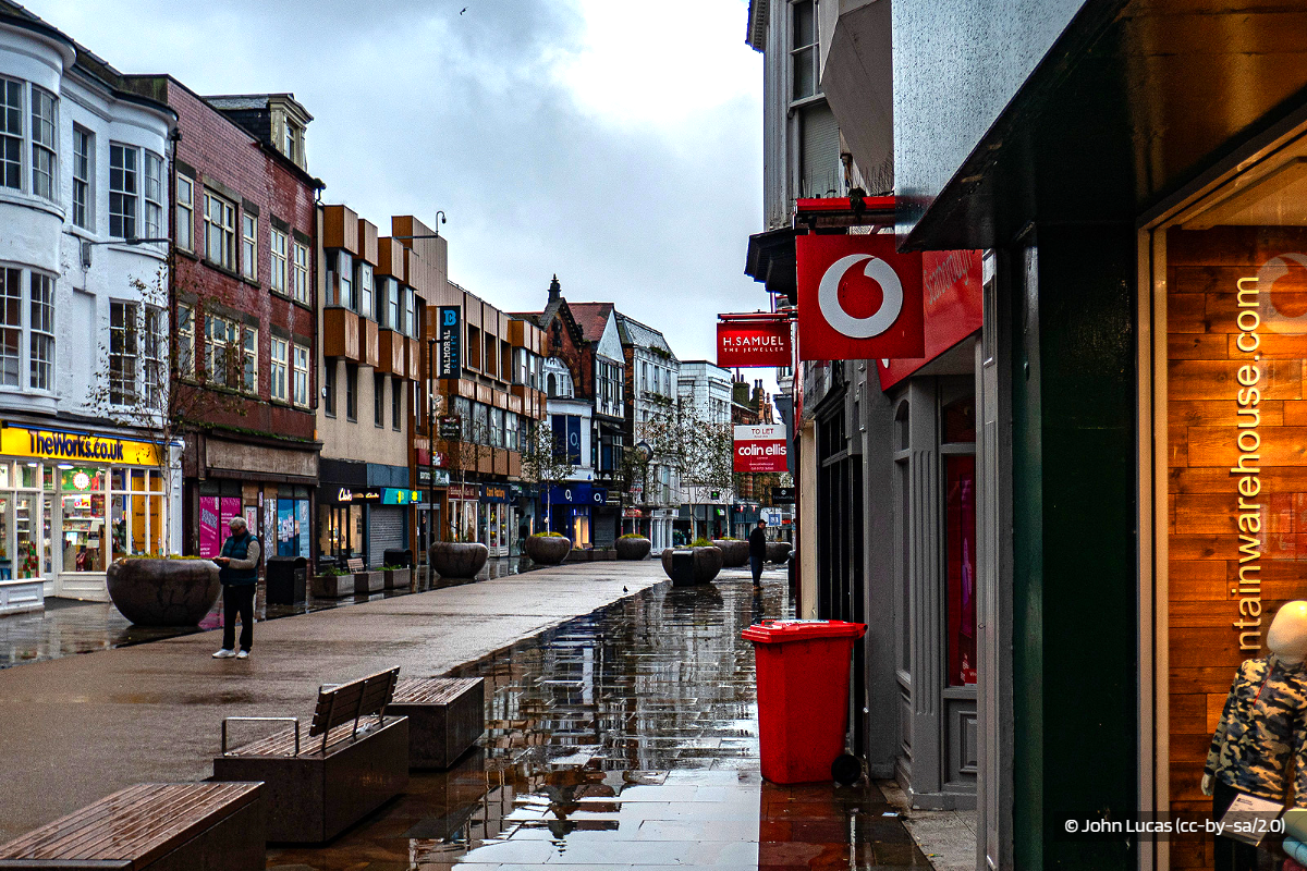 Scarborough MP: New and Exciting Things Opening Up
 Scarborough Athletic Face South East Hike
 Whitby Town Chase Rushall Double
 Bridlington Town Back At Home With Consett Tuning Up
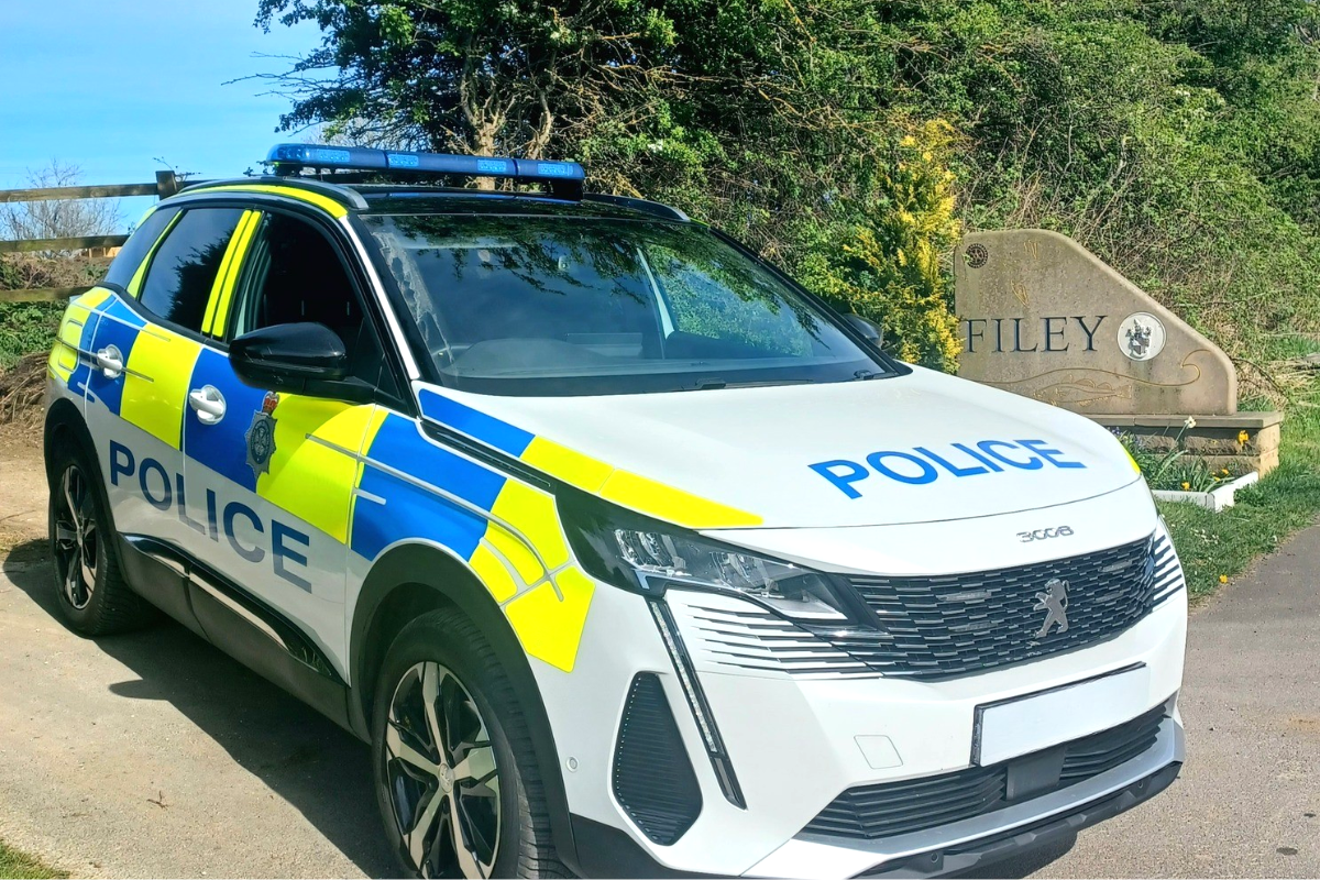 Operation Scooter Targets Moped and Motorcycle Theft in Eastfield and Filey
 Scarborough and Bridlington Rugby Try To Stay On Top
 Pickering Town's Destination is Doncaster
 Challenges for North Yorkshire Moors Railway as Historic Bridge Repairs Hit Complications
 Goodbye and Thank You to Whitby RNLI Chairman, Mike Major
 Police Appeal After Night-time Assault in Whitby
 Scarborough Darts Players Push Professionals In UK Open


Comments
Add a comment